Abondance
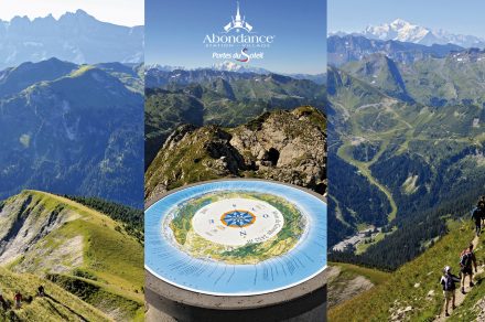
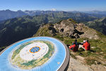
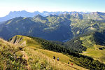
The Mont de Grange (2432 m) is one of the best known of the Chablais Massif. At its summit, you will discover a view of the whole valley of Abondance, the Lake Geneva basin, the Jura, the Valais Alps, the Giffre, the Aravis and the Mont Blanc Massif.
The departure is in Saint Théodule at the place called Follebin in Abondance, take the path towards the chalets of Bailly and Jouly. Then join the chalets of Lenlevay.
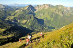
Continue on the path that goes up on your left then take the path of the Coincon ridge on your left. This leads to the top of the Mont de Grange. This last part is quite steep.
Services & Equipement & Activités
- Orientation board
Type d'activité
- Pedestrian sports
- Hiking itinerary
Type d'itinéraire
Type d'itinéraire : ALLER_RETOUR
Infos générales
- Référence cartographique : n/c
- Référence topo : n/c
- Dénivellation positive : 1130m
- Dénivellation négative : n/c
- Passages délicats : Just before the top.
- Précision balisage : Follow the different directions indicated in the description.
- Altitude moyenne : 2000m
- Altitude minimum : 2432m
- Distance : 12.6km
- Pente moyenne : n/c
- Durée journalière : 05h00
- Durée itinérance : n/c
Tarifs
Free access.
Localisation
Langues parlées
- French
Pour réserver contactez l'hôte
Bien configurer les codes de template des formulaires dans le back office, Options -> Formulaires