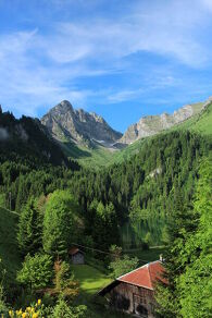
The Charmy l'Adroit mountain pastures
A beautiful panoramic walking trail on the moutain alpine of Abondance with a view on the Switzerland and Chablais peaks, and a discovery of the mountain chalets.
Main itinerary: Go down to the lake, follow the direction of Chalets de Lens by the refuge des Tindérêts. The 2 itineraries meet before the Chalet de Cubourré. Shorter variant: go up the stony path, direction refuge des Tindérêts.
Mark 1: follow the path that goes up the combe d'Ardens in front of you. In this valley, you can still see below the Ardens chalets, the
marks the action of the glacier 12,000 years ago, which as it retreated left rock deposits (moraines) in the form of a long cord.
Mark 2: leave the path to follow the path that goes up to the Tinderets hut. This path is marked out with numbered markers and with the topo guide taken at the tourist office or at the refuge, you can discover the botany of the area.
Take the path above the refuge through a coppice of green alders; these shrubs colonize the combes and avalanche paths and bend in winter under the weight of the snow.
After crossing the large schist couloir, climb the few steps shaped with tree roots to reach Aup Couti. This last passage can be tricky for people who are not initiated to the mountain.
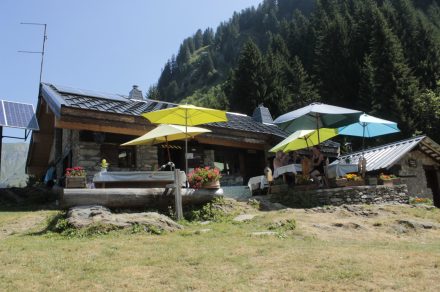
Mark 3: reach the Lens mountain pasture by the path on the left. After 200 m, you will discover the Lens Mountain, below its chalets. The word "Mountain" here refers to the mountain pasture where pastoral activity is practised. When you arrive at the chalets, take advantage of the goat (a wooden fountain dug in a tree trunk) to quench your thirst.
Mark 4 : continue the path that goes down to the Chalets de Lens . At the crossroads, you can shorten the circuit by reaching the Plagnes car park in 45 minutes (alternative).
Marked 5 : otherwise, continue the hike towards the Lenlevay chalets. After a long but easy climb, you reach Les Covagnes (or Covagny), you are on the GR5. Turn left, direction the chalets de Lenlevay, just before them, you will have to turn left to follow the path of the chalets du Jouly up then down. From Lenlevay, the highest point, exceptional panorama on the Swiss summits and the Chablais. Alpine meadows and rhododendron moors are the natural habitat of the heather roosters (capercaillie).
Mark 6: continue the path to the oratory Les Trables (you are on the tour of the Mont de Grange). Take the path on the left which goes down into the grass and joins an old path through the forest (beacon). At the path, turn left towards Tetagotay, then right down to the edge of the meadow. At the bottom of the valley you can see the Lac des Plagnes, you are soon there.
Services & Equipement
- Picnic area
- Pets welcome
Ouverture
From 01/05 to 15/11.
Subject to favorable weather.
Tarifs
Free access.
Animaux
Animaux: Acceptés
Langues parlées
- French
Bien configurer les codes de template des formulaires dans le back office, Options -> Formulaires